Under the hood of BBOWT’s ecological dataflow: from programming to mapping

Under the hood of BBOWT’s ecological dataflow: from programming to mapping

Surveys help to monitor the condition of nature reserves and inform how BBOWT manages them. Photo by BBOWT

Assistant Data & GIS Officer, Ryan Ellis takes an in-depth look at what happens to all the data collected by volunteers and staff for BBOWT

From birds and butterflies to mammals and reptiles, every year volunteers, trainees and staff alike carry out hundreds of ecological surveys, collecting thousands of biological records from every major taxonomic group. 

So what happens to those biological records after the survey is complete and the records are submitted: how are they processed? And how are they used to measure – and enhance – our conservation efforts across our nature reserves?

Having been out on one of our nature reserves, completing a particular survey to record a taxonomic group such as reptiles or birds, the surveyor returns to the office the completed paper form. From here, a laborious process takes place to move the data into its final databases for storage and analysis.

A standard dataflow is to digitise the survey data into an electronic version, then compile all the data for that survey for the year into a master file, upload this file to the relevant analysis database and finally upload it into Recorder 6 (our ultimate database for all records from all survey types).

Two people looking through binoculars in a meadow

Volunteers help to survey a wide variety of species and habitats. Photo by Ric Mellis

A straightforward dataflow, on the surface… These dataflows get mightily more complicated due to the necessary recording to track the progress of surveys throughout the year, recording and tracking of exactly where the data from each survey is in the dataflow, and verifying/validating data at each step to prevent or resolve errors that may incur.

Surveying many different taxonomic groups, which all require different survey methodologies, further magnifies the complexity and level of organisation needed to process all the data. By carrying out an additional survey methodology, there will be a whole new dataflow that must be processed in parallel to all the other survey dataflows. 

To develop these dataflows that require a large amount of labour and time, we are gradually writing programmes to perform the repetitive tasks that take the most time. The benefits of writing programmes are many: they can save a lot of time, prevent errors that can incur from manually handling the data, can identify errors that could be missed when checking manually, are repeatable, are a written record of exactly what was done to the data, can be further developed in the future, and can oftentimes produce superior formatting (from graphs to manuscripts) and more complex analysis than front-end software.

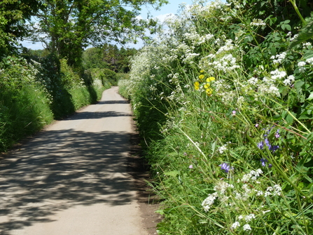
Flower-filled road verge along a country road

One example of writing programmes to develop the dataflow is with the data entry for the West Berkshire Wild Verges Project. Surveyors were given the option to either return their survey forms in a paper form or in a digitised electronic version. If the surveyor returned the data in the electronic version, then a programme previously written can be executed to automatically compile the data from every individual survey into a master spreadsheet, ready for data analysis in almost an instant. Writing programmes such as these is an approach we are working on to develop our dataflows more widely.

After the surveys have been carried out and the dataflows complete, we can then begin to analyse the data and develop our understanding of the ecology in our nature reserves.

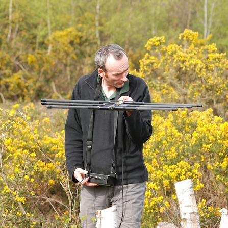
radio tracking

For this next section I would like to briefly discuss the outputs from the telemetry surveys of adders of Greenham and Crookham Commons. Adders are a reptile native to the UK and in decline. A species that is in need of conservation efforts to prevent extinction. They continue to face many threats: habitat loss, predation by introduced species such as pheasants, and targeted persecution by the public.

Adders can be persecuted by the public, usually because of the perceived threat to people and their dogs because adders are venomous. However, adders are incredibly secretive creatures and will seek to avoid conflict with people and their dogs wherever possible. An altercation with a human or a dog could not only leave the adder wounded (if not dead), but also the necessary exertion of energy required to fight would reduce its chances of survival thereafter. Consequently, due to the devastating persecution of adders, locations of adders from these surveys will remain confidential.

During the spring and summer of 2015, 2016 and 2022 numerous adders across Greenham and Crookham Commons were tagged with radios and tracked every two days, until the snake sloughs its skin and the tag retrieved. This was an intensive survey exercise for one species.

The goal was to gain insights into how the adders use the habitat across the reserve and elucidate possible barriers to migration. For each consecutive location an adder was located at when surveyed, connecting lines were mapped spatially to infer the shortest distance and direction travelled. It is well known that adders like habitat with plenty of cover so they can remain hidden and undetected, from both predators and prey.

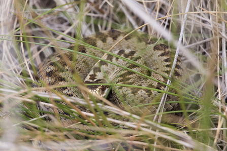
Adder by Chris Lawrence

Adder by Chris Lawrence

The data from the surveys supports this notion, with the ecotone between the woodland and grassland being particularly important habitat. Further inspection of the mapped data revealed compelling evidence that the road passing through Greenham and Crookham Commons was a barrier to migration. It is therefore likely that the road has fragmented the adder population into two separate populations, with adders on either side of the road reproductively isolated. With no cover at all on the road to provide safe passage, the adders likely perceive the road as an environment too dangerous to traverse, too much risk of predation.

In addition to the environmental pressures for adders (habitat loss, predation from introduced species such as pheasants, and persecution from the public), when their populations become sufficiently small and genetically isolated, there is a series of genetic processes which can accelerate the decline to extinction of that population.

Genetic diversity is the fundamental reservoir of variation within a population that allows large populations to undergo natural selection and evolve in response to environmental change. When a change to the environment arises, such as climate change or a novel disease, a population must adapt to this change to continue to flourish and reproduce.

Under new environmental conditions, if a genetic variant encoding a different phenotype provides an advantage to survival and reproduction, then individuals within the population with this genetic variant will reproduce more successfully and the population will gradually evolve in favor of this more successful genotype – natural selection.

However, when a population is small, the process determining which genetic variants are passed onto the next generation is no longer governed by natural selection, but instead by randomness, in a process called genetic drift. When genetic drift is the dominating process, genetic diversity is lost over time. With less genetic diversity, the resilience and reproductive fitness of the population reduces, leading to further population decline.

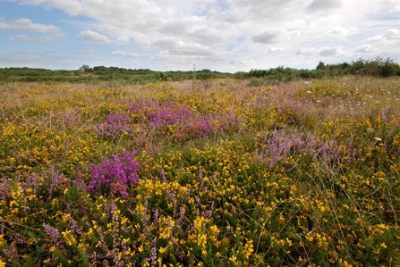
Greenham Common, West Berkshire Living Landscape, by Rob Appleby

Furthermore, as the population gets smaller, the rate of inbreeding increases. Inbreeding leads to increased rates of genetic diseases, but also reduces individual fitness through a process called inbreeding depression, leading to further population decline. This becomes a cycle, a downward spiral of population decline, losing genetic diversity and reproductive fitness with each generation.

This downward spiral, leading a population to extinction is a phenomenon called the extinction vortex. The way to prevent or rescue a small and genetically isolated population from the extinction vortex, is to increase the size of the population and introduce new genetic diversity.

From mapping the telemetry survey data of the adders at Greenham and Crookham Commons, we have compelling evidence to suggest the road is fragmenting our adder population into two smaller ones.

Given the detrimental impacts of small, isolated populations, it would be advantageous to increase the habitat connectivity across the road. This would ensure the population remains as large and as genetically connected as possible, boosting their long-term viability. Possible interventions could come in the form of land bridges over the road, or underpass tunnels underneath the road. This would also likely benefit a whole host of other species whose habitat connectivity is reduced by the roads.

Only made possible by the hard work, dedication and passion from our volunteers, trainees and staff, this is just one example of insights we gain of our wildlife from across our nature reserves of the three counties, guiding our conservation efforts on the ground.

A big thankyou to all our surveyors for all your hard work and commitment in helping us.