
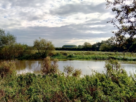
Aerial view of Duxford Old River and Chimney Meadows by Phill Pentecost AVP
Chimney Meadows Wetland Restoration Project
Find out more about our exciting Wetland Restoration and Fish Passage Project at Chimney Meadows Nature Reserve.
About the Chimney Meadows Wetland Restoration and Fish Passage Project
Restoring a stretch of the Thames, tackling the climate crisis, and creating wonderful new habitats for wildlife.
In December 2019, the Berkshire, Buckinghamshire and Oxfordshire Wildlife Trust (BBOWT) secured funding through the European Agricultural Fund for Rural Development to deliver landscape scale restoration of river and floodplain habitats at Chimney Meadows Nature Reserve.

Map showing Chimney Meadows and Duxford Old River Nature Reserve
We all have a role to play in tackling the climate emergency. Climate change is causing continually changing conditions that have both a global and local effect on the water ecosystem. We need to think about new ways of managing our land to help nature and wildlife flourish as conditions change.
BBOWT set about looking for natural solutions to these two challenges. We couldn’t control flooding in the winter, but we could develop ways to keep water on the floodplain in spring and summer for longer. This would help stabilize the effects of climate change on our reserve and help local wildlife such as curlew, through developing wetland habitats for the future.

Curlew by Chris Gomersall/2020Vision
We have also provided new ways for fish to move up and down the River Thames through our reserve, making things easier for them during dry summer periods, when in-river barriers impeded their movement most. We have opened access to approximately 30km of river habitat just by addressing fish passage for species such as barbel, chub and dace on our reserve.
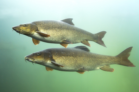
Barbel, one of the many fish species that will benefit from this project. Photo by Rostislav for AdobeStock
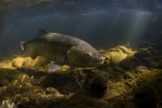
Chub will benefit from the fish passage improvement works at Chimney Meadows. Photo by Jack Perks.
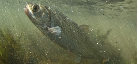
Species like dace will also benefit from improved fish passage in the Thames. Photo by Jack Perks.
Our physical and mental well-being are dependent on access to the natural world. This has become increasingly important in recent times and our work has been done with nature, wildlife and people in mind. You will be able to see and enjoy much of the work we have completed from the extensive network of public access routes that run through our reserve and find out more on periodic guided walks. We have also constructed a new bird hide and viewing location in the centre of our reserve from which you will be able to enjoy the landscape and its wildlife more closely.
BBOWT has worked directly with a professional team of specialists to develop and consider the hydrology, ecology, flood risk and planning requirements of the project, in addition to the various contractors involved in delivery and construction. The project was completed in December 2021 and we’re very excited about the outcomes.
Find out more about what we've achieved
Below you can find details of all the things we have done on the reserve. We have prepared a map that shows where different things have taken place. Use the headers below the map to navigate round the page to learn about the different parts of the project.

Annotated map of Chimney Meadows Nature Reserve and Duxford Old River, showing the areas the Wetland Restoration Project will focus on.
What we have done
(click the headers below to navigate to the relevant section of the page)
Improving opportunities for fish passage
- Shifford Weir
- Duxford Ford
- Great Brook Ford
Enabling a healthier and more active floodplain
- Duxford Old River Land
Restoring river and floodplain habitats
- Duxford plantation and triangle
- Home Russia backwater
- Chimney Meadows Site of Special Scientific Interest (SSSI)
- Home Russia and Lower Baingey paleochannels
Tackling non-native invasive species and combating rural pollution
- Chimney Meadows Site of Special Scientific Interest (SSSI)
- Himalayan Balsam control
- Improving habitat for water voles
Improving the experience of visitors
-
Updated orientation and interpretation boards
Improving opportunities for fish passage
During low flows, fish migration routes around Chimney Meadows and consequently through the Upper Thames were impeded. In addition, the in-river barriers restricted access to potentially good quality spawning grounds.
The project enabled us to modify the structure of two fords and create a bypass channel around Shifford Weir. Consequently, course fish can freely access 22km of water course that they could not previously, along with 2.1km of new potential spawning grounds, 620m of existing spawning grounds and newly placed gravels in Wadley Stream.
These works will make fish populations more sustainable, contributing to a healthy river ecosystem and making them more resilient to environmental change.
Shifford Weir
The river environments in this area are classified as having poor ecological status. One of the reasons for not achieving good status for fish was barriers to fish passage. Therefore, making changes to enable fish passage was a key objective of the project.
Prior to the project starting, Shifford Weir limited fish passage between the Duxford Loop and the River Thames. The structure is owned and operated by the Environment Agency and plays an important regulatory role on the navigability and flood risk management of this part of the Thames. As such, in order to improve fish passage around Shifford Weir, any new arrangements needed to carefully balance the varied uses of this location.
We considered and assessed a series of options and consulted extensively with the Environment Agency to select a preferred option. Following this, BBOWT applied for planning permission to construct a ‘naturalised’ bypass channel of approximately 450m in length with the incorporation of wetland habitats along its length which will provide optimum passage for slower swimming fish.
The design of the bypass was optimised in close liaison with the Environment Agency and, as part of this, the design team carried out a series of investigations to inform the design and minimise impacts. These included flood risk modelling to inform hydraulic design, topographical surveys, geotechnical investigations, ecological surveys, tree and hedgerow surveys, archaeological investigations and geo-archaeology in collaboration with consultees such as local planning authorities and Oxfordshire County Council.

Sketch of the proposed bypass channel around Shifford Weir. Photo by Atkins, 2020.
A flythrough video of a similar natural bypass channel around another weir on the River Thames.
Duxford Ford
As described above, the river environments in this area are classified as having poor ecological status and one of the reasons for not achieving good status for fish is barriers to fish passage. As such, making changes to enable fish passage was a key objective of the project.
Duxford Ford allows users of the public right of way to cross the river flowing along what is known locally as the ‘Duxford Loop’. For much of the year, the concrete structure is fully submerged but under low river flow conditions the jump up onto the deck of the ford is too great to allow fish to cross.

Duxford Ford. Photo by Atkins, 2020.
In order to rectify this problem at Duxford Ford, a series of options were assessed, including potential removal and replacement of the structure, as well as a number of less intrusive measures to manage flows and, consequently, aid fish passage.
In June 2020 BBOWT consulted all residents of Duxford in person and the preference for the majority of residents was for the ford to remain a ford, i.e. with water running over its surface. Having reviewed the options in light of this, BBOWT applied for planning permission to place a series of stones on the downstream side of the ford to create a fish easement. The fish easement is made up of a ring of 52 precisely placed blockstones which holds back (impounds) the water as it flows over the ford. This increases the depth of water within the ‘rock pool’ (which has also been filled with gravel), raising the water level next to the ford, creating a much smaller step up to the ford, making it easier for fish to pass over it and move upstream during low flows.

Indicative illustration of the stone step on the downstream side at Duxford Ford. Photo by Atkins, 2020.

Diagram showing side profile of proposed step at Duxford Ford.

Example of water flowing over a stone step.
Great Brook Ford
The Great Brook is currently classified as having a moderate ecological status. As is the case in other areas, one of the reasons for not achieving good status for fish is barriers to fish passage. As such, enabling fish passage into the Great Brook at the Ford was a key objective of the project.
Great Brook Ford allows users of the public right of way (footpath 114/5/10) to cross the Great Brook. For much of the year, the structure is fully submerged but under low river flow conditions the depth of water over the structure is insufficient to allow fish passage.
As was the case in other areas, at Great Brook Ford, a series of options were assessed, ranging from removal and replacement to less intrusive measures to aid fish passage.
Following confirmation that the works at this location did not require planning permission, we proceeded to fit a series of baffles - small strips that are fitted to the existing downstream face of the submerged concrete structure, leaving the structural surface unaltered. In normal flow conditions these have no effect on flow. However, in low flow conditions, the baffles direct the flows to pass over one half of the submerged concrete structure, thereby slightly increasing the depth of flow, and aiding fish passage. This is a tried-and-tested approach for river restoration and fish passage.

Annotated photo of baffles fitted to the ford. Photo by Atkins, 2020.
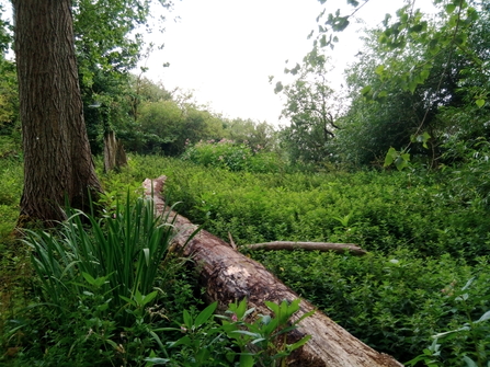
Enabling a healthier and more active floodplain
The main channel of the Thames and the Duxford Loop are both embanked on both sides as they flow through Chimney Meadows, resulting in the loss of natural flooding regimes and consequent reductions in the ecosystem services of flood storage and water quality maintenance.
The project has enabled a more natural flooding regime in addition to the creation of, river and floodplain habitats over 45 ha. The flow will be slowed as it crosses the land by natural retention methods and flooding elsewhere will be alleviated. There will be benefits by way of increased flood storage capacity and improved water quality regulation, as sediments and nutrients are deposited, as well as ecological benefits, as new wetland habitats develop.
Duxford Old River Land
Duxford Old River was purchased by BBOWT in 2017 as an addition to the existing reserve, following an appeal to BBOWT members and supporters. The land was seen as desirable for BBOWT to take on, partly as a result of its position, giving management control to land on both sides of the river; and because of its history of having a lack of cultivation, giving rise to the potential for significant wildlife value. The 45 hectares of land at Duxford Old River was made up of five fields separated by a network of hedgerows and ditches.
The objective for Duxford Old River was to re-naturalise floodplain operation meaning this BBOWT land would flood earlier and retain water for longer, whilst not increasing flooding on neighbouring land. These conditions would restore natural floodplain habitats and boost biodiversity.
Following extensive hydraulic modelling to inform the detailed design in collaboration with the Environment Agency, a series of options were assessed. The proposal that was favoured for implementation was a combination of the elements below.
Scrapes
Shallow excavations to retain water for longer into Spring and to provide additional habitat, a well-established method for wet grassland habitats.

Visualisation of potential scrapes at Chimney Meadows (provided by Atkins).
Restoring the effects of land drainage
All the watercourses that run through the Duxford Old River area have been engineered to drain to the Wadley Stream. We installed two small earth mounds in the existing drainage channels, with flexible pipes to slow down water flows and allow wetland habitats to naturally extend beyond the current channel limits.

Standard flexi pipe design for use in wetland enhancements
Wadley stream enhancement
We introduced berm features into the Wadley stream channel at a select number of strategic locations to improve flow and create new gravel spawning grounds for fish.

A berm created as part of river restoration works on the Upper Wensum. (Photo provided by Atkins)
Restoring river and floodplain habitats
Across the UK many floodplains have been simplified, with water courses straightened, land drained and wetland features filled in, resulting in loss of habitat for wildlife and reductions in ecosystem services such as flood water storage and water quality maintenance.
The project has enabled us to continue to restore river and floodplain habitats and ecosystem services at Chimney Meadows on 260ha of land to the north of the river and now deliver a wetland restoration scheme on 45ha of land at Duxford to the south.
Not only will species associated with rivers and floodplains be able to colonise newly created habitats and thrive at Chimney Meadows Nature Reserve, but also spread from this core area of good quality habitat to other areas in the Upper Thames Living Landscape.
In addition to other measures previously mentioned to create a healthier and more active floodplain, the following habitat enhancements have taken place:
Duxford plantation
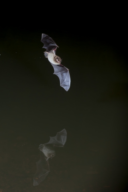
As a wildlife charity we are very conscious of the value of trees in the landscape, for people and for wildlife. As such, an important part of the project involved re-stocking the plantation of hybrid poplar trees at Duxford, either side of the Duxford ford. The poplars were probably originally planted as a crop and were over-mature and collapsing, causing a hazard. In addition, there were very few young trees growing to replace them. The poplars were felled, leaving the beautiful willows and standing deadwood, which provides excellent habitat for insects, woodpeckers and bats. This was followed by the planting of new woodland, creating a mixed native woodland including oak trees, willows and a greater variety of native broad-leaved trees which thrive more naturally in such riverside locations. In addition, the old pill box on site was converted into a bat hibernaculum to further enhance the area for biodiversity.
View of Duxford showing the poplar plantation.
The poplars at Duxford were planted as a crop and are now over mature and in places hazardous. Selective felling would allow the native woodland to thrive.
Home Russia backwater
Home Russia is a field that forms part of the Thames floodplain on the northern, Chimney side, of the river. The northern boundary of the field is delineated by an old backwater channel which carries water from the River Thames into Chimney Meadows that had become silted up and shaded by scrub and young willow trees. As part of the project, scrub clearance and pollarding took place, followed by desilting of the channel and replacing fencing in the area.
Home Russia and Lower Baingey water channels
Within the fields named Home Russia and Lower Baingey there are two natural water channels, one of which was desilted a few years ago with consequent benefits for floodplain species, dependent on aquatic habitats. The funding has enabled BBOWT to desilt the second channel and control water levels using a water control structure located where the channel ends meet the ditch adjacent to the River Thames. This will help retain water on the floodplain for longer to provide feeding grounds for wading birds and boost diversity of aquatic plants and insects.

Home Russia Old paleochannel when wet. Retaining water on the floodplain creates feeding grounds for wading birds.
Chimney Meadows Site of Special Scientific Interest (SSSI)
Chimney Meadows SSSI is primarily designated for its neutral species-rich grassland. Being situated on the Thames floodplain, the wildflower meadows flood each year. The fields are divided by ditches which drain off the seasonal floodwaters. Following periodic ditch maintenance, an activity required to keep the meadows in favourable condition, material had accumulated to form a raised bank adjacent to the ditches, impeding the flow of water and drainage of the fields. As part of the project, gaps were created within the banks of material to improve the free movement of water across the floodplain and enable natural processes.
Tackle invasive non-native invasive species and combat rural pollution
Chimney Meadows Site of Special Scientific Interest (SSSI)
Much of the riverside fencing on Chimney Meadows SSSI was deteriorating and in need of replacement to ensure livestock, which graze the floodplain meadows, did not access and pollute the River Thames. The project enabled BBOWT to remove the existing fence and replace it, ensuring there is no further degradation of river banks and helping improve river water quality by keeping livestock out of the water course.

Photo by Darren Tansley
Himalayan balsam control
The project has enabled us to continue controlling the spread of Himalayan balsam across the Chimney Meadows Nature Reserve. Without continued control, this non-native invasive species takes over ditches and grassland, causing riverbanks to erode having a negative impact on water quality and reducing the diversity of native species of flora and fauna.

Himalayan Balsam - an invasive species which erodes riverbanks and reduces the diversity of native flora and fauna. Photo by Gillian Day.
Improving habitat for water voles
Our Water Vole Recovery Project identified the area around Chimney Meadows as having important water vole habitat. Reducing predation of water voles and other aquatic wildlife will make their populations become more resilient to environmental change and help these native species to colonise the newly enhanced habitats at Chimney Meadows Nature Reserve and the wider Upper Thames.

Mink control helps the recovery of threatened native water voles. Photo by Terry Whittaker/2020VISION.
Improving the experience of visitors
We have installed new orientation and interpretation boards at Chimney Meadows Nature Reserve to help visitors’ orientation and allow them to engage with and learn about this precious place and value the natural world that supports us all.

Interpretation boards will help visitors enjoy and learn about this precious place. Photo by Simon Turnbull.
Key species
Find out more about the wildlife that will benefit from the Chimney Meadows Wetland Restoration Project.


Key habitats
Find out more about the habitats we are restoring and protecting.


